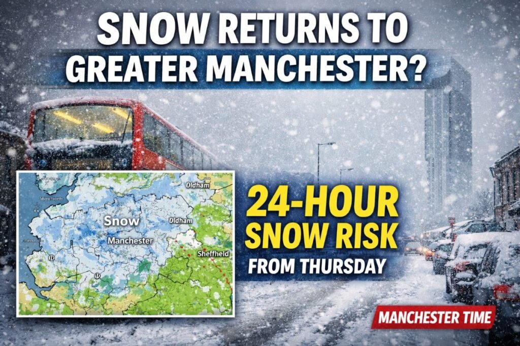
The snow forecast Greater Manchester residents are watching closely suggests wintry weather could return later this week, with Met Office maps indicating up to 24 hours of snow for some eastern parts of the region from Thursday.
Greater Manchester is bracing for another spell of cold conditions as the latest forecasting data from the Met Office shows snow pushing into higher ground from late Thursday morning. While widespread disruption is not expected, areas close to the Pennines could see sleet and snow lingering through Thursday night and into Friday morning.
Earlier today (Wednesday, February 4), elevated parts of Greater Manchester recorded light snowfall under a yellow weather warning for snow and ice, which expired at 9am. Although no further alerts are currently in place, updated Met Office snow maps show another band of wintry weather approaching the region within the next 36 hours.
What the Met Office Maps Show
According to the latest data, snow is expected to begin east of Rochdale and Oldham from around 11:30am on Thursday. The snow forecast Greater Manchester forecasters are tracking shows wintry showers spreading during the afternoon, with the heaviest snowfall focused on higher ground around the Pennines and the Peak District.
By mid afternoon, wintry conditions are expected to affect large parts of the eastern and northern edges of the city region. Hill snow is likely to settle and persist, while lower lying urban areas may see sleet or cold rain, particularly across central Manchester and western boroughs.
Met Office maps indicate these conditions could persist overnight into Friday morning, creating a prolonged and locally significant period of wintry weather for communities bordering the high ground.
Snow Forecast Greater Manchester
Wednesday, February 4
Temperatures reached 8°C, though exposed areas felt colder. Light snowfall was recorded on higher ground during the morning before clearing. Overnight lows fall to around 3°C, with frost possible in sheltered spots.
Thursday, February 5
This marks the main snow risk. Wintry precipitation arrives from late morning, with snow most likely east of Rochdale and Oldham. Temperatures peak at just 5°C, with ‘feels like’ values dipping below freezing in exposed areas. Overnight lows fall to around 1°C.
Friday, February 6
Snow retreats to higher elevations early in the morning before turning to rain across most of the region. Temperatures recover slightly to around 7°C, leading into a largely dry but cloudy weekend.
Why Some Areas See Snow And Others Don’t
The difference between hill snow and urban rain is a key feature of this week’s snow forecast Greater Manchester residents often question. Elevated areas of the Pennines remain colder, allowing snow to settle, while lower-lying parts of Manchester tend to hover just above freezing.
This is why boroughs such as Oldham, Rochdale and parts of Tameside regularly see snowfall when Manchester city centre experiences only rain or sleet. The Peak District, bordering the region to the south-east, is also prone to heavier accumulations during these setups.
Travel and Public Safety: What Commuters Should Know
While widespread disruption is not anticipated, conditions could be challenging on exposed routes.
Roads:
The M62 trans-Pennine route, A628 Woodhead Pass, and Peak District crossings are most at risk. Drivers in eastern boroughs should allow extra time and avoid unnecessary travel during Thursday afternoon and evening.
Public transport:
Rail routes crossing the Pennines may experience delays, with Network Rail typically deploying overnight de-icing teams when snow is forecast. Metrolink services are expected to operate but could see minor delays on exposed sections.
Preparing for Snow
Councils across Greater Manchester are monitoring the situation and are expected to deploy gritters on key routes. Residents are advised to:
- Travel only if essential during heavy snowfall
- Check the latest Met Office updates before setting out
- Allow extra journey time and drive cautiously
- Be alert for icy patches overnight and early Friday
Manchester Airport has confirmed snow-clearing teams are on standby, though passengers are advised to check travel arrangements in advance.
What Happens Next?
Beyond Friday, long range forecasts suggest temperatures will remain near or slightly below average, with further wintry showers possible over higher ground. While no major snow events are currently predicted, the snow forecast Greater Manchester forecasters are tracking remains changeable.
Residents are advised to stay informed, particularly those living near the Pennines or travelling across higher routes.
If snow does arrive, readers are encouraged to share their photos and experiences as Greater Manchester navigates another classic North West winter spell.


