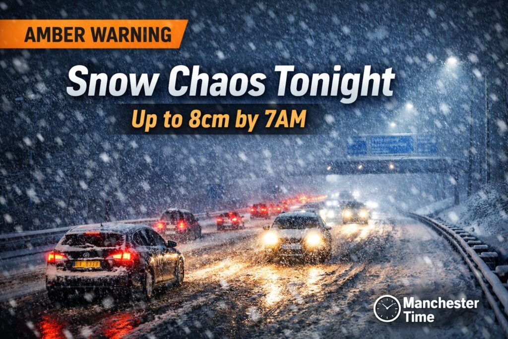
Weather snow UK warnings have been issued across large parts of the country as a band of wintry precipitation moves east over the next 24 to 48 hours. In parts of northern England, daytime temperatures are struggling to rise above 1–2C, with wind chill making it feel several degrees lower. Manchester sits close to the main snow band, with higher parts of Greater Manchester and the Pennine fringe at risk of 3–8cm of settling snow and widespread ice during the morning commute.
With fresh Met Office weather warnings snow alerts in force, disruption to travel, schools and NHS services is a genuine possibility.
Breaking Update Summary
Who issued the warning: The Met Office has issued weather snow UK warnings for snow and ice.
Warning level: Yellow warnings cover much of England, Wales, Scotland and Northern Ireland. Amber snow warnings apply in parts of northern England and Scotland where heavier accumulation is likely.
Timing: Warnings run overnight and into tomorrow, with further icy conditions possible into the following day.
Regions affected: Scotland, Northern Ireland, northern England including the North West and Yorkshire, parts of the Midlands and higher ground in Wales.
Why it matters: Accumulating snow, ice and strong winds could lead to hazardous driving, rail delays, isolated power cuts and localised school disruption.
Weather Snow UK Forecast
North West
Across the North West, rain, sleet and snow will push in from the west, increasingly turning to snow above roughly 200–300 metres.
- Snow totals: 3–8cm on higher ground east of Manchester
- Lower levels: Slushy covering possible
- Temperatures: 0C to 3C
- Wind chill: Feels below freezing
- Ice risk: Significant after dark
Motorways including the M60, M62 across the Pennines and stretches of the M6 could see rapidly changing surface conditions, particularly before 9am.
Yorkshire
Closer to the cold air source, Yorkshire may see 5–10cm in places, especially across the Moors and Dales. Snow showers lining up on a north-easterly wind could increase local totals. Ice risk will be high overnight where surfaces remain damp.
Midlands
More marginal here, with rain, sleet and snow mixing depending on elevation. Urban areas such as Birmingham are more likely to see wet snow that struggles to settle. Icy stretches remain possible overnight.
Scotland
Parts of Scotland face the most persistent snowfall under amber warnings, with 10–20cm widely and up to 30–40cm on the highest ground. Drifting and temporary whiteout conditions are possible in exposed areas.
London and South East
Snow is less likely to settle widely, though sleet and brief snow are possible on the northern edge of a developing low pressure system. Ice risk remains lower than in northern regions.
Manchester Local Impact
For Greater Manchester, marginal temperatures mean small shifts could quickly turn rain to snow.
Roads
- Gritters deployed on priority routes
- M62 Saddleworth Moor particularly exposed
- Estate roads and pavements likely untreated
Drivers could move from wet to slushy surfaces within minutes.
Rail
Services crossing higher ground towards Leeds, Huddersfield and Sheffield may face speed restrictions if snow settles on points and signals.
Airport
Manchester Airport may experience de-icing delays if snowfall intensifies overnight.
Schools
City centre closures are less likely in marginal conditions, but schools on higher ground east and north of Manchester could consider delayed openings if snow accumulates before 7am.
NHS
Winter pressures are already elevated. Snow and ice often bring an increase in falls and minor road collisions.
What the Met Office Says
The Met Office explains that weather snow UK warnings reflect both likelihood and impact.
- Yellow: Some disruption possible.
- Amber: Disruption likely, including travel delays and possible power outages.
- Red: Dangerous conditions with risk to life.
Forecasts are updated frequently as model data shifts. Warning areas may expand or contract as confidence levels change.
When Snow Hits
Tonight:
Snow showers continue in Scotland. Rain and sleet move into the North West late evening.
Tomorrow morning:
Band of rain, sleet and snow crosses northern England. Manchester faces potential icy commute before 9am.
Tomorrow afternoon:
Main band clears south-east. Colder air follows, leaving scattered wintry showers.
Following day:
Cold persists. Ice likely on untreated surfaces. Further updates possible as next system approaches.
Practical Advice
Driving: Reduce speed, increase stopping distance, check travel updates before leaving.
Walking: Use gritted paths, wear footwear with grip, beware of black ice.
Heating: Ensure boilers function properly and pipes are protected.
Vulnerable residents: Check on elderly neighbours and ensure medication supplies are adequate.
Car emergency kit: Blanket, torch, phone charger, snacks and water.
Closing
The latest weather snow UK warnings underline the risk of disruptive but locally variable conditions. For Manchester and the wider North West, the focus is on the morning commute and untreated surfaces as temperatures hover near freezing.
Monitoring official updates remains essential as conditions evolve.
FAQ:
When will it snow in the UK?
Snow is affecting parts of Scotland and moving into northern England overnight. Timing varies by region, so local forecasts should be checked frequently.
Will Manchester get heavy snow?
Lower parts of Manchester may see slushy coverings, while higher areas east and north of the city could see 3–8cm during heavier bursts.
What does an amber snow warning mean?
An amber snow warning means disruption is likely. Travel delays, road closures and power interruptions become more probable compared to a yellow alert.
How long will the snow last?
The heaviest snow is expected over a 12–24 hour period, followed by colder conditions with further icy risks.
Will schools close?
Decisions are local. Schools on higher ground are more likely to adjust opening times if roads become unsafe.
How accurate are Met Office snow forecasts?
Forecasts are highly advanced but snowfall totals can vary locally due to small temperature differences of 1C.


